Friday, October 28, 2011

Kildare National Stud Farm, Kilkenny, and Waterford

20 September 2011


When someone signs up for a tour, many things are packed into any given day.  On day four of our tour we traveled from Dublin to Waterford and saw two renowned sites along the way.


Our first stop was the Irish National Stud Farm along with its Japanese Gardens and Museum.


Most horses are born during November, December and January.  
Since we were visiting in September, there were not any colts, expectant mothers, or stallions available for viewing.  There was one mare and baby available.  She is a miniature horse and her colt was about the size of a Labrador Retriever.
 Our guide explained that the little horse is not a pony because genetically she is more horse than pony.  


Our guide stated that during the spring months, these fields are full of mares and colts. 
 The stallions are kept in stalls in the "barn."  These stalls are heated, air conditioned, and very large.  I would guess that they are at least 20' by 20.'
 The gardens are exquisite.  They were built in the 1930's so the plants are mature.
 The pond had several Swans.  This guy had somehow gotten himself in a part of the pond that was separated from the rest by a small dam.  He kept bumping into the wall as if it would move for him.
 It would not be a Japanese garden without an arched bridge. This view made me think of Monet's  "Water Lily" pictures.
An isolated grotto just a few hundred yards from the Stallion's barn.


Kilkenny Castle & Park:

Lunch time brought us to Kilkenny.  As indicated in an earlier blog, visitors had to pay to see the inside of the castle but the grounds could be viewed for free. 
 This castle pre dates Dublin castle by at least 100 years.  According to our guide, the castle and town used to have a wall surrounding it.  All remnants of the wall have disappeared.
 The local Lord lives here with his family and servants.
 This is a view of the street that leads to the castle.  The kiosk on the left is a bus stop.  The buildings on the right are shops and restaurants that are open to a central courtyard.  We ate lunch in one of them.
 After lunch we visited the gardens on the other side of the castle.  The formal entrance to the castle is at the center of the building on the right.  The entrance to the gardens is in the foreground.
 It was necessary to climb stairs to access the gardens.  When standing on the stairs it seemed like the stairs to the veranda continued upwards but in reality they were 50 or 60 feet away.

 Waterford:


This is a pub where we went to have a pint.


The home of the famous Waterford Crystal plant.  We toured the sales room and a mock-up of what happens when preparing crystal.
 Much of the process is now done by computerized robots.  Our tour guide indicated that 70% of the workers no longer work for Waterford.


St Paul's Cathedral was much smaller than other cathedrals we viewed in Dublin.
 This is one of the streets in the city of Waterford.


We were disappointed with Waterford.  We had to pay 18 Euros each extra for the walking tour and felt as if we did not get our money's worth.  The tour lasted about 30 minutes.  


When we got back to our hotel, we found out that the concierge had a self-guided tour map that would have been more informative than the tour we had to pay extra for.


Dublin Ireland

18th & 19th September 2011


Millions of Americans claim either Irish or Scot ancestry.   The name "Tosh" can be traced to clan MacIntosh in the Highlands of Scotland.  For many years, it has been my wish to visit that part of the world to see what my ancestors left behind.  So, upon retiring, we did just that - signed up for a tour.  The company we chose did not offer just Scotland, so we selected a two-week tour titled "The best of Ireland and Scotland."  This blog and the next few will share our experiences.


One of the things that was distinctive about Dublin that I regret not taking pictures of is the front doors.  It is said that during King George (1700's) many of the row houses were built.  Originally, all of the front doors were the same.  When the men came home at night, often in "their cups" they had a hard time distinguishing which house to go into.  The wives got together and painted them all different colors.  One now sees bright red, green, yellow, white, and black doors.  No two doors in the same block are the same color.


Ireland, being an independent nation, is part of the European Union.  The currency is therefore the Euro.  The exchange rate was about $1.50 for each Euro.  We were constantly having to mentally calculate the difference when buying things.


 Dublin Castle:


These are the gates to the castle.  Over the centuries, the castle has evolved from a medieval structure to an 18th century series of buildings.   The gates are off of a busy street and, for the most part, unnoticeable.
The Governor's/President's residence (next picture below) is immediately to the left as you enter.  The structure in front (on the right with the clock tower) houses court rooms and solicitors offices.  The building to the right as you enter the courtyard is Representatives and Departmental offices.  The central courtyard is approximately 100 meters square.
 During the 18th and 19th centuries, this was the official residence of the Governor  appointed by the British crown.  In 1922, Ireland became an Independent nation - no longer governed by Great Britain.  For several years, this was the official residence of the Irish President.  However, he no longer lives here.
This is the entry hall (on the second floor) where Official visitors would be escorted to visit the Governor or President.   Our tour guide indicated that the gold on the ceiling reliefs is 24 carat.

The building that houses various governmental Departments has a gate in the center that leads to a side street.


Notice that the cobble stones of the courtyard date back several centuries and are said to be older than the surrounding buildings.
 St. Patrick's Cathedral:


Dublin is noted for its many churches.  This cathedral has been here since the 1600's


Its exterior is magnificent.  However, we found that after paying thousands of dollars to get there, almost everything cost an extra fee.  They wanted 12 Euro per person to go inside.  So, we enjoyed the exterior.


That is my daughter Jennifer walking towards the camera.
 To the North of the Cathedral was a large beautiful park.


Every day it rains for a while, 10 to 15 minutes at a stretch.  As a result, everything is very green.
 The park has a large fountain in the center.  Because it had just stopped raining a few minutes before, there were not many people in the park.
 The pictures do not do justice to the beauty of the architecture.
 The rain squalls, began again as we were leaving the park.
 Christ Church:


The main part of the church is to the right.  The bridge across the street leading to the religious library is an exact replica of the Bridge of Sighs in Italy.
 Here too they were charging admission, 14 Euro per person to tour the church.  We elected not to go into the church.

Jefferson National Expansion Memorial


The 15th of September 2011 found us in St Louis, and naturally we had to go see the famous Gateway Arch.  The Arch is part of the Jefferson National Expansion Memorial.


St Louis is known as the Gateway to the West.  During the 1700's & 1800's most people wanting to "go West" had to take a trail that went through St Louis.


The Jefferson National Expansion Memorial was established in 1935 to commemorate the westward expansion.


Originally, the monument was comprised of the Old Courthouse, Luther Ely Smith Square, and a large vacant area between Memorial Dr and the Mississippi River.


In 1947 a contest was held to determine what structure would be build on the vacant property.  The design for the Gateway Arch, by Eero Saarnen, won over 172 other entries.   
Construction began in 1963 and was completed in 1965.


Although we knew that the arch was 630 feet tall, it was impossible to realize the actual size of the monument until standing directly in front of it.


The viewable panels are part of a sandwich: stainless steel outside, carbon steel inside, and concrete in the middle.


The visitor's center is beneath the arch (under the park) with entrances at each touch point.  It is comprised of a large museum, two stores and two theaters.  


We rode up to the top in "tram" cars, similar to Ferris Wheel cars.  The view from the top is breath-taking.  If you are ever anywhere near St Louis this is a must see.

Sunday, October 23, 2011

Canyon de Chelly National Monument & Window Rock AZ


10 September 2011


America's other "Grand Canyon" lies just a hundred miles or so north east of the more famous canyon.  One of the reasons it is not as well known is that it lies entirely within the Navajo Reservation and therefore is "off the beaten path."


The 10th of September 2011 found us visiting Canyon de Chelly National Monument for the first time.


The name de Chelly is actually pronounced "d'SHAY."  


The name is derived from a Navajo word that the Spaniards attempted to translate; hence the spelling that appears strange to English speakers.


Travel in the canyons is only permitted with a park ranger or Navajo guide.  Therefore, visitors must view the canyons from the two established roads:  North Rim Drive or South Rim Drive.  We took the drive along the South Rim.  

The first view we had of the canyon was with a backdrop of thunder clouds moving in.  The rain storm passed over quickly with less than five minutes of actual rain.
Archeological evidence indicates that these canyons have been inhabited for over 5,000 years.


Even in early September, when most of the region is parched, the canyon floor was lush an vibrant while up above on the mesa there were only a few desert plants. 


Looking over the side of the canyon's steep walls made objects below appear in miniature.  The white rectangle in the middle of this picture next to a tree is the roof of a house.  The furrows around the house is a corn field.

I thought the Grand Canyon was breath taking, this canyon (series of canyons) is just as beautiful.  


With the mesas all around, the canyons are almost invisible until the edge is approached.
Canyon de Chelly National Monument is actually comprised of a series of canyons:  Canyon Del Muerto on the North has a side canyon called Black Rock Canyon and Canyon de Chelly on the South has two side canyons called Bat Canyon and Monument Canyon


At the junction of Canyon de Chelly, Bat Canyon, and Monument Canyon is Spider Rock.  There is a Navajo legend about a woman called the "Spider Woman" that lived on top of the rock.  She is said to have been a powerful healer and fortune teller.  People from all over the nation would go to her for advice and healing.
Since the entire canyon system is part of the Navajo reservation, non natives are not permitted to visit the canyons unescorted.  Several Navajo families have their homesteads on the canyon floors.  They raise sheep, goats, cattle, and food crops such as corn.  


This is Spider Rock from a slightly different perspective, also later in the day so it is in shadow.
If you look closely, I had binoculars, at the indentation in the rock face, there are traces of cliff dwellings.  


Archeologists have dated these and similar dwellings in the cliffs to approximately 1000 years ago.  This one is named "The White House" because of the white plaster that was used in the construction.


The 2.5 mile path/trail down to the White House is the only trail that visitors are allowed to explore without a guide.  Signs indicate that visitors must stay on the path.


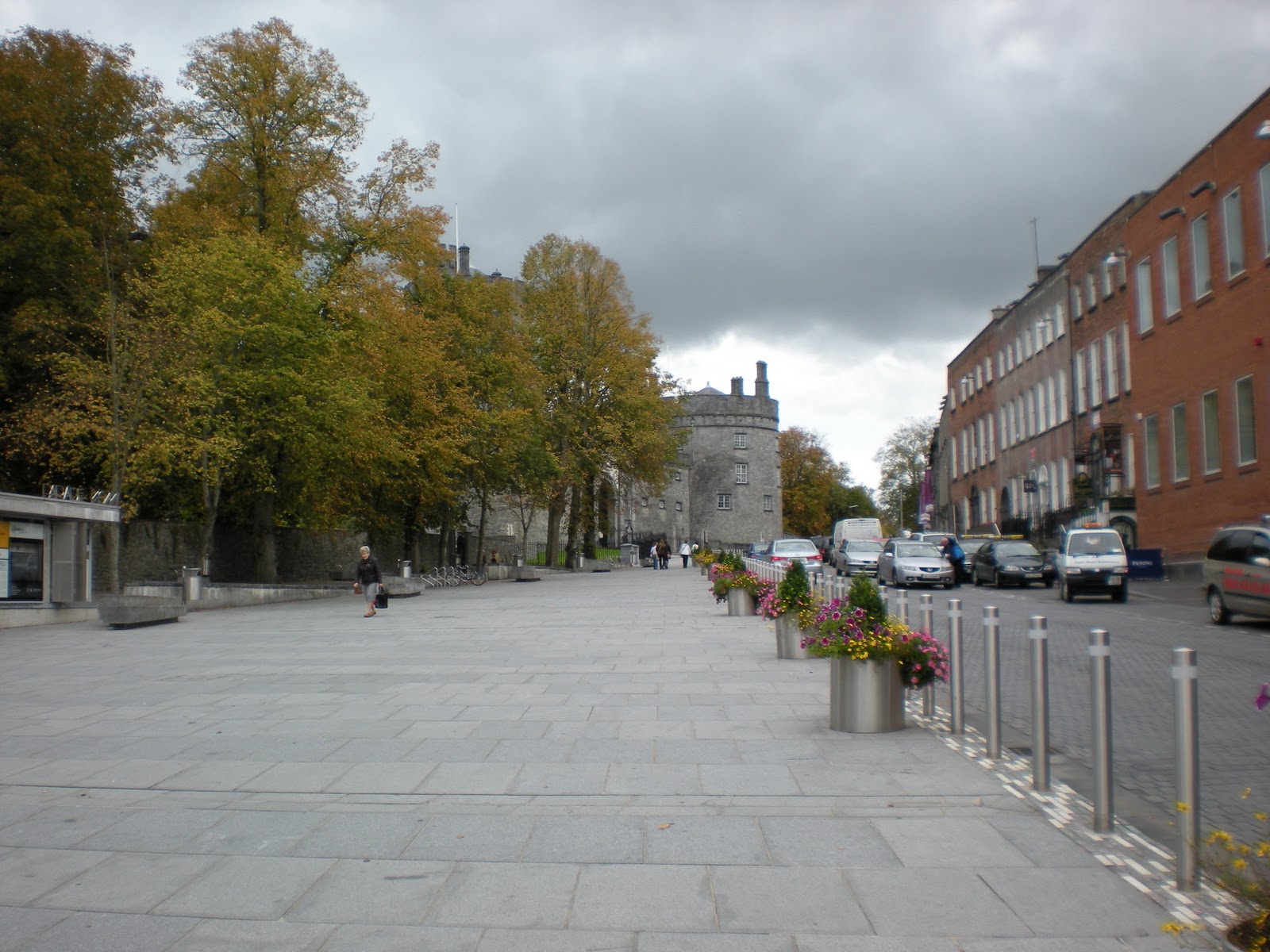
This little known park is a spectacular find.  Unlike the popular parks, the day we were there had very few visitors.  


The Monument is accessed from Chinle Arizona.  It is approximately two hours north of Interstate 40.  

There is a campground adjacent to the park entrance.  Camping spaces are on a first come first serve basis.  Since we were there so late in the year, there were quite a few spaces available.

The following day, we attended a Pow Wow at Window Rock AZ.  This is an example of the couples dance competition.  The dancers are judged on the costume authenticity and the accuracy / expertise of dance movement.  The couple at the beginning of the line took first place.

After the couples dance competition we watched the individual dance competition.

Again, the dancers were judged on the authenticity of movement and costume. 


In addition, there was a drum circle competition.  Each participating drum circle had 8 to 10 drummers. Each drum circle played for 10 to 15 minutes.  The judges went to each circle, listened to the music, and observed the techniques used.
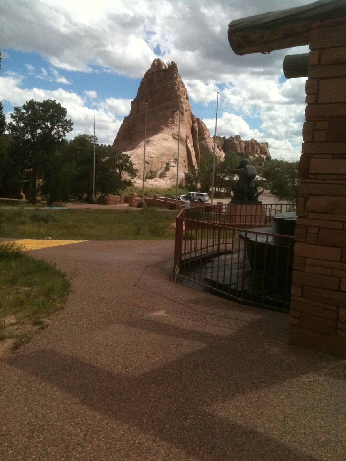
 After the Pow Wow, we visited the rock that the town was named after.  


From a distance, the hole in the rock does look similar to a window.
 I don't know whether you can tell but there are two climbers at the bottom right hand edge of the window.  Look just to the left of the flag pole.
These pictures do not do justice to the actual size of the "window" in the rock.

My best guess would be that the hole is at least 50' in diameter.


Walking closer to the wall that was in the earlier picture, the size of the hole is more evident.
When I turned around, while still standing next to the wall in the earlier picture, the rock in this picture was adjacent.  On the right is a memorial to the Navajo that served in World War II.